
A post on X (formerly Twitter) from an account called Ali Abunimah, published on September 26, claims that Google Maps has been updated with new imagery showing what the poster describes as a devastated area of Rafah, a city in Gaza. The post, which had reportedly drawn millions of views and thousands of reactions, includes an image the poster says depicts “part of Rafah” following what the caption calls “Zionist-holocausted Gaza.”
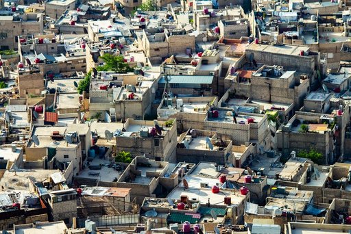
The post does not include verifiable details such as the date of the underlying satellite imagery, the exact coordinates shown, or confirmation from Google about when or why the map data was updated. No official statement from Google or independent analysis of the imagery is included in the available material.
A reply to the post, from an account called Brattani, states that Apple Maps shows different imagery for the same area, without visible destruction, and calls the discrepancy “dystopian.” This reply suggests that different mapping platforms may be displaying different versions of imagery for the same location, but no further explanation for the discrepancy is provided in the source material.
Because the claim originates from a single social media post without accompanying documentation, satellite imagery metadata, or corroboration from Google, news organizations, or independent researchers, the extent and accuracy of the described destruction cannot be confirmed from the available text. The post’s framing, including its characterization of events in Gaza, reflects the poster’s own description rather than a verified report.
Rafah, located in the southern Gaza Strip, has been the subject of extensive reporting over the course of the conflict between Israel and Hamas, though this particular source does not provide additional context, background, or timeline about military operations or other events that might explain the imagery referenced in the post.
The viral spread of the post, evidenced by the reported view count and engagement figures, indicates significant public interest in claims about the state of Rafah and in comparisons between different digital mapping services. However, without additional verification, the specific claim that Google Maps has been “updated” to reflect new destruction, and the scale of that destruction, remains unconfirmed based solely on this source.
Readers should treat the claim as an unverified social media report pending confirmation from Google or independent imagery analysis.
Key facts
- A post on X by an account named Ali Abunimah, dated September 26, claims Google Maps imagery was updated to show destruction in part of Rafah, Gaza.
- The post reportedly received about 3.8 million views and thousands of likes, reposts, and comments.
- A reply from an account called Brattani states that Apple Maps shows different, non-destructive imagery for the same area.
- No corroboration from Google or independent sources is included in the available material.